Dear MGIS Users,
It is almost the end of the first quarter of 2021 and so here is some news about MGIS data and features.
Data update
We spent time cleaning up morphological characterization and agronomic data stored in the database. In total 14,640 data were updated out of 225,970 characterization records.
We also updated 145 CARBAP plantains with Characterization & Evaluation data extracted and translated from the Catalog of Plantains from CARBAP. As 112 out of those 145 plantains have an ITC code, we transferred the dataset to the corresponding ITC collection to enrich their description and facilitate accession order. This represents about 50 descriptors per accession.
With the help of Descriptors Graphical Interface Selection (DGIS) released at the end of last year, it is now possible to use them to filter and manage accessions.
Publications associated to individual accessions
- The impact of slow stomatal kinetics on photosynthesis and water use efficiency under fluctuating light
- Filling the gaps in gene banks: Collecting, characterizing and phenotyping wild banana relatives of Papua New Guinea
- Identification of Divergent Isolates of Banana Mild Mosaic Virus and Development of a New Diagnostic Primer to Improve Detection
- Cultivar specific gene pool may play an important role in Musa acuminata Colla evolution
- Effect of Seasonal Drought on the Agronomic Performance of Four Banana Genotypes (Musa spp.) in the East African Highlands
- Association genetics of bunch weight and its component traits in East African highland banana (Musa spp. AAA group)
- Genome ancestry mosaics reveal multiple and cryptic contributors to cultivated banana
- Guidelines for the Evaluation of Resistance to Pseudocercospora Leaf Spot Diseases of Banana
- Phenotyping Musa spp. for host reaction to Fusarium oxysporum f. sp. cubense, under greenhouse and field conditions
Field Verification
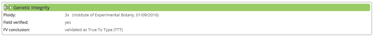
The ITC accessions continue to be field verified. So far 863 accessions have been verified or are under verification. The result of the field verification of ITC accessions is found in the Genetic Integrity section of each accession page.
If the result of the verification confirms the True To Typeness of the accession, then we display this information:
If we don't yet have the information, then we display this message:

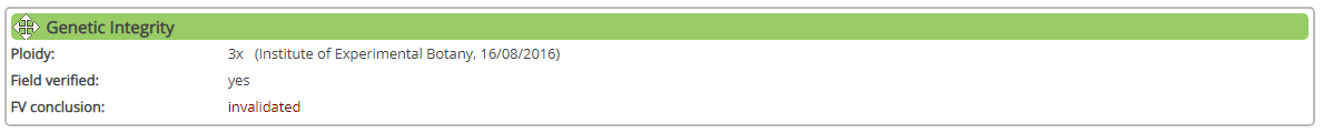
At last if the accession verified is different from what is expected (and therefore no longer available for distribution) then the message is the following:
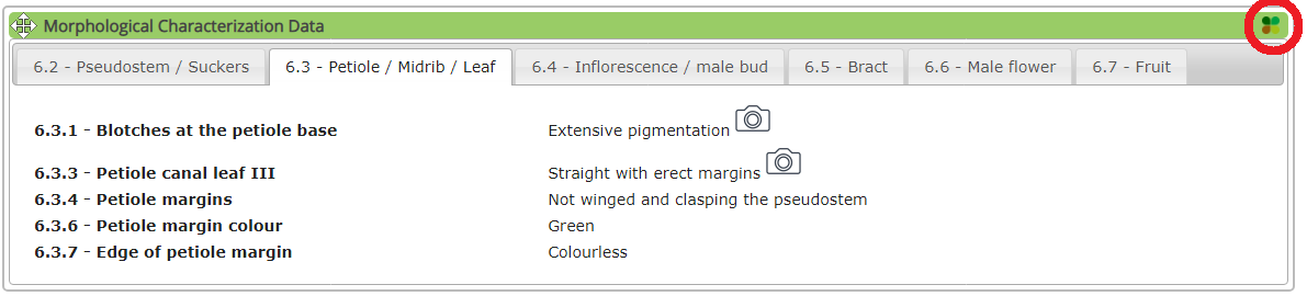
Characterization data and BrAPI
When morphological characterization data are available for one accession you can get these data under BrAPI format, which is a JSON file format. To do so just click on the BrAPI on the upper right corner of the Morphological Characterization Data box: 
Once clicked a new page will open displaying the JSON formatted result of all the Characterization data.
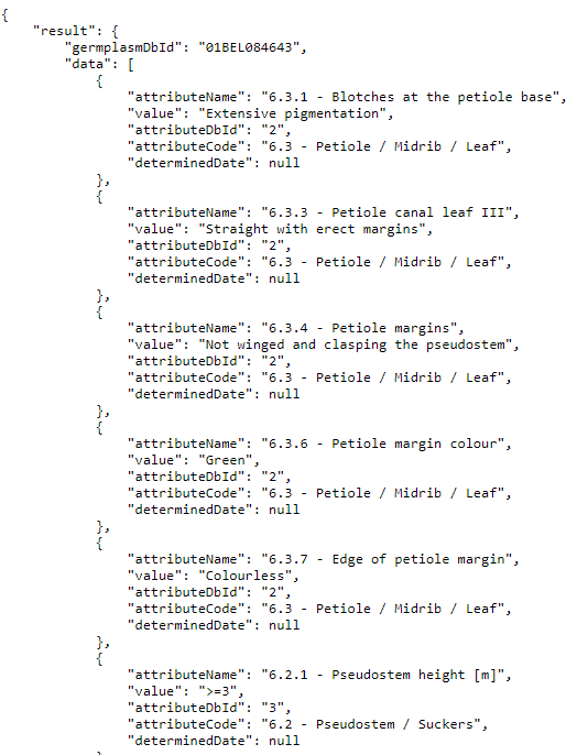
For developers, you have the details of the BrAPI call on this page or you can test first what your call will return from here.
MGIS web site in 2021
As previously announced in the December News, we are working on a new version of MGIS web site. As usual we are open to any feedback to help improve MGIS. We are in charge of the database, but it is you, the data providers and scientists, who are the end users.